Aerox transforms drone-captured imagery into decision-ready reports — combining autonomous flight planning, survey-grade image processing, and defect detection trained on real infrastructure data from the energy sector.
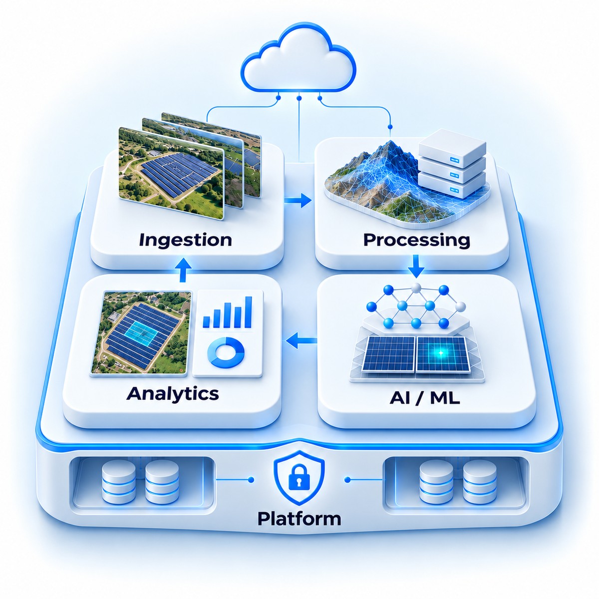
A continuous, four-stage pipeline turns aerial data into decision-ready insight — no manual stitching, no spreadsheets, no guesswork.
Autonomous drone missions capture high-resolution imagery across assets and terrain. AEROX supports RGB, thermal, LiDAR, and multispectral sensors — every frame automatically GPS-tagged and timestamped for precise geospatial accuracy.
Raw imagery runs through our photogrammetry pipeline to generate orthomosaics, 3D surface models, and dense point clouds — handling overlap alignment, color correction, and geometric calibration to survey-grade standard.
Computer vision models detect objects, identify anomalies, and measure change over time. Industry-specific models recognize vegetation encroachment, structural defects, equipment presence, and thermal anomalies.
Insights surface through interactive dashboards, automated alerts, and exportable reports. Teams measure distance, area, and volume directly on the map, with critical findings triggering notifications to the right stakeholders.
Every output is georeferenced to real-world coordinate systems (UTM, WGS84) and produced at a resolution built for defect-level analysis — not just pretty maps.
Ground sample distance (GSD), flight-altitude dependent
Positional accuracy with RTK / PPK GPS
Images per hour, cloud processing throughput
Output formats: GeoTIFF, OBJ, glTF, LAS, KML, Shapefile
Infrastructure components (towers, poles, transformers, panels), vegetation and encroachment zones, equipment, and physical defects including cracks, corrosion, and missing components.
Supervised and unsupervised models identifying structural deformation and damage patterns, thermal hot spots and insulation failures, and environmental anomalies such as erosion or flooding.
Temporal comparison across surveys — stockpile and volume changes, elevation and subsidence tracking, construction-progress-vs-plan, and vegetation growth/encroachment monitoring.
Instead of a fixed list of detections, Aerox configures search parameters around known site issues, OEM concerns, operating history, and asset-owner priorities — then routes every finding into the systems your team already uses.
Hotspot flagged with GPS location and severity score.
Evidence, timestamp, and confidence notes recorded to the register.
Findings routed automatically into maintenance task systems.
A follow-up flight confirms closure and checks for recurrence.
| Layer | Technology & Purpose |
|---|---|
| Hardware Abstraction | SDK adapters for multiple drone vendors (DJI, Autel, PX4). Sensor-agnostic ingestion for RGB, thermal, LiDAR, and multispectral. |
| Flight Planning | Mission design with waypoint optimization, coverage calculation, obstacle avoidance, and airspace compliance. |
| Image Processing | Photogrammetry engine for orthomosaic stitching, 3D mesh reconstruction, point cloud generation, and georeferencing. |
| Detection Models (AI/ML) | Computer vision for object detection, anomaly identification, classification, and change detection, with industry-specific model training. |
| Analytics Engine | Measurement tools (distance, area, volume), time-series comparison, trend analysis, and automated reporting. |
| Data Platform | Cloud-native storage — object storage for imagery, time-series database for telemetry, PostgreSQL for metadata. |
| Web Platform | Modern web frontend, high-performance backend APIs, container orchestration, and multi-tenant architecture. |
Five service domains work together to deliver the complete workflow: ingestion, processing, AI/ML inference, analytics, and platform services — including SSO-ready authentication, multi-tenant data isolation, and a rate-limited API gateway.